
From the southernmost point of Luxembourg, my journey continued north toward Belgium and its own southern extremity, located near the village of Torgny. The quickest route there passes through the far northern edge of France. In these regions, it’s hard to tell exactly when you’ve crossed from one country to another — the landscape flows seamlessly, and there are few signs of change.
That said, I did notice one difference when I stopped at a Lidl to buy a salad. The French, to put it diplomatically, can be rather self-centered shoppers. Someone was making a massive grocery run — hundreds of euros’ worth — which of course created a long queue. When the announcement came that a second register would open, a man from the very back suddenly sprinted forward with just a few items, determined to beat everyone else to the front. There wasn’t much discussion about fairness — just the simple law of opportunity.
While waiting, another customer’s beer pack slipped from their hands, shattering into what felt like a million pieces across the floor. And when I finally stepped outside and sat down in my car, I saw the same man — the one who had rushed to the register — struggling to get his car out of the parking spot.
The drive to Torgny took about an hour. The countryside unfolded beautifully along the way — rolling fields and quiet villages that must look especially lovely in summer, when everything is in full bloom. Just as I had hardly noticed crossing from Luxembourg into France, the transition from France into Belgium was equally invisible, marked only by a modest “Welcome to Belgium” sign.
I had done some research before arriving, finding photos online of motorcyclists who had visited Belgium’s southernmost point. The map showed a narrow road leading there, and it looked like it could be driven by car as well. That was the plan. However, finding Luxembourg’s southernmost point earlier in the day had already taken quite a bit of time, and by the time I reached this small, picturesque village, I discovered that most of its streets were one-way. Google Maps wasn’t particularly helpful either, so after driving the quiet lanes back and forth a few times, I decided it would be wiser to park and continue on foot.
The parking area was right in the heart of the village. Clouds were still moving quickly across the sky, but the morning rain from Luxembourg seemed to have passed for now. A quick risk assessment suggested I could leave my jacket behind — always a small act of optimism. The streets were silent; not a soul in sight. Perhaps everyone was at work, or maybe it was just that kind of afternoon.
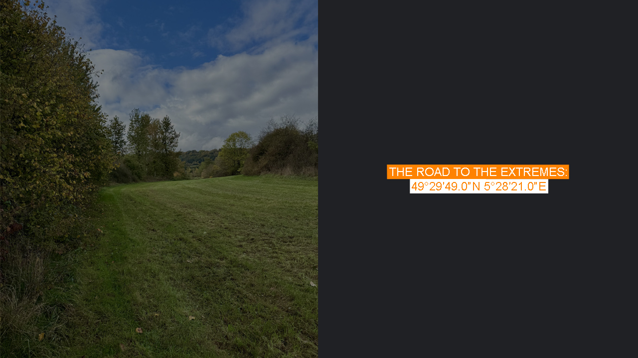
With a bit of navigation, I found the right road leading south, across the fields toward the Belgian border. The village was small, but charming — simple, rural, and unpretentious. When I reached Rue Jean, I started walking toward the fields, wondering what the local landowners might think of strangers like me wandering through their property from time to time. The path seemed drivable, though it ultimately led nowhere but to open farmland.
Fresh tire tracks crossed the grass, and it looked as if someone might have recently driven there — perhaps a farmer. The rain had made the ground muddy, and although my shoes were already wet from the morning, they certainly weren’t getting any drier now.
If I were to describe the place, I’d say it was purely rural, much like the village itself — golden autumn colors spreading across the landscape. Behind me, on a distant hill, Belgian houses stood above the valley, while ahead lay France beneath dark clouds. Yet what drew my attention most was a solitary, perfectly shaped tree standing in the middle of a field — striking in its symmetry, like a natural monument.
I walked downhill across the muddy field, at first thinking I had reached Belgium’s southernmost point. When I opened the map, I realized I was slightly too far north. The real point lay just beyond a hedge of bushes and a line of barbed wire. Getting there was easier said than done.
I noticed a small gap in the bushes where the wire had been bent — evidence that someone had crossed there before. I didn’t want to ruin my clothes, so I kept searching for an easier passage and eventually found one: a narrow path through the shrubs, low and tangled, almost requiring me to crawl. It was only a few meters long, but still, it felt like a small adventure in itself.
This short detour brought me straight to the banks of the Chiers River — a 140-kilometer waterway flowing westward. Its source lies in Differdange, Luxembourg, which, interestingly enough, is also where Luxembourg’s southernmost point is located. What comes around goes around, as the saying goes.
Here, the border between France and Belgium begins to follow the course of the Chiers. Belgium’s southernmost point lies just a little north of the river. In the past, there used to be a small red wooden marker, but it was nowhere to be seen now. According to local rumors online, the landowner often removes the marker — and he has every right to, as the area is private farmland and visitors occasionally wander across it.
The vegetation along the river was thick, making it nearly impossible to see any boundary stones or markers. After some time observing the quiet scenery, I came to the conclusion that Belgium’s southernmost point is a truly peaceful and hidden place — serene, rural, and undisturbed.
It struck me how the same river that marked this border also rose near where my morning had begun — as if the day itself had drawn a quiet circle through the landscapes of Luxembourg, France, and Belgium. What comes around goes around, indeed.
On the way back, I briefly considered trying to climb over the barbed wire at a different spot, but it was clear I’d just end up tearing my clothes, so I decided to return exactly the same way I came. Finding the small gap in the bushes from that direction was surprisingly difficult, but eventually I made it through.
As I walked back toward the village, I found myself wondering about that lone tree in the middle of the field — who had planted it, and what stories it could tell. If trees could speak, this one would surely have countless tales, not only of farmers and travelers like me, but of everything that has passed through this quiet corner of Europe over the centuries.
When I reached the village, it was as silent as before. The sense was that summer’s liveliness had long passed, and the place was now quietly waiting for the next season to bloom again.
Back at the car, I still had the salad I’d bought earlier at Lidl. I opened it, only to realize there was no fork included — and, of course, no shop nearby to buy one. The salad had already been sitting in the car for a while, and I was getting hungry, so postponing wasn’t an option. For a brief moment, I considered eating with my hands, but they weren’t exactly clean after the muddy walk.
Necessity breeds invention: I ended up crafting a makeshift utensil from the wrapper of some Kinder bars I’d also bought earlier. Improvised luxury at its finest — the kind you only find on trips like these. And surprisingly, it worked well enough. I just hoped that no one would look from a window and end up filming this show.
By the time I finished eating, it was already two in the afternoon. I knew the day was far from over, but just how long it would still become — that, I would only discover later. After a final glance at the quiet village, I started the car and set off again, this time toward Luxembourg’s westernmost point.