
Fall arrives every year—whether we want it or not. And yet, its arrival always manages to surprise us, much like the first snowfall surprises every driver. Some people enjoy the season, but for me, the only gift it brings are the astonishing colors nature puts on display.
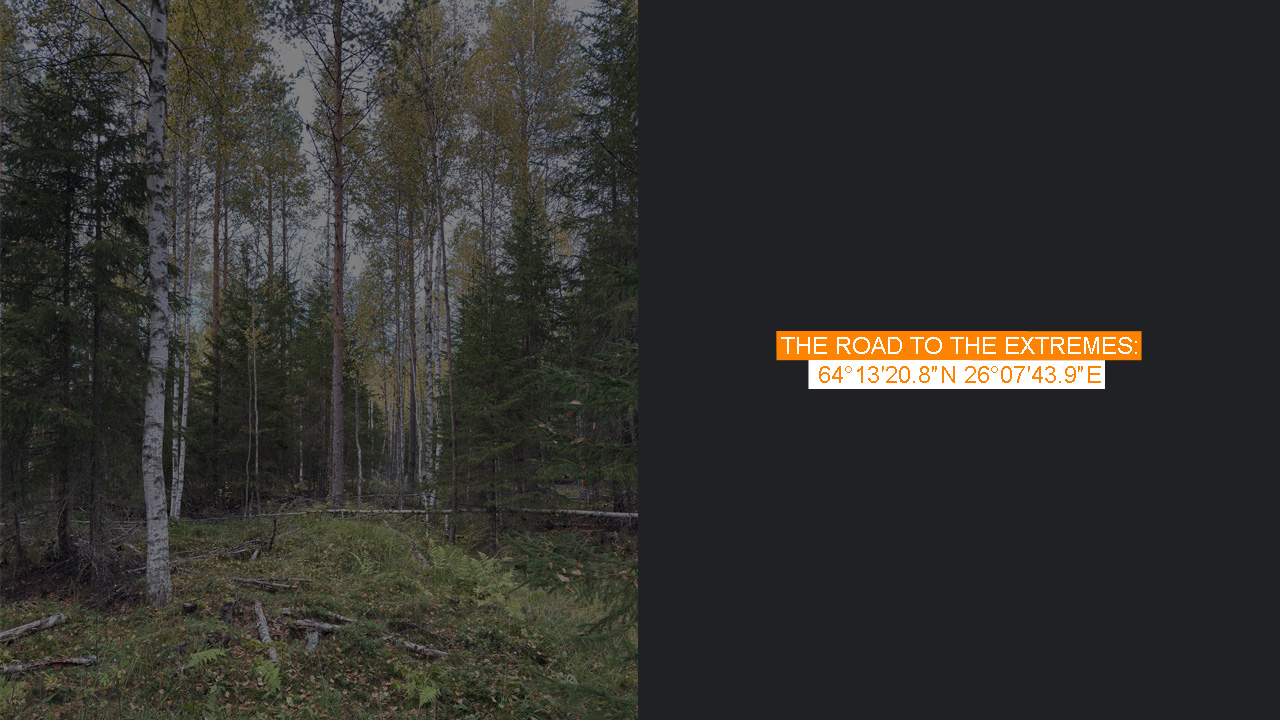
Here, in the very middle of Finland, it’s clear that fall has taken hold. The morning was cold and foggy. The deciduous trees have turned yellow, yet somehow I’ve managed to separate myself from all that. The day is relatively warm, probably one of the last warm days, and I’m sweating slightly under my hoodie. It’s white—probably not the smartest choice for the forest—but that’s the least of my concerns. I feel a little paranoid.
The nearest asphalt road, where I turned off onto gravel, is only two kilometers away. Still, it feels like I’m completely alone in the middle of nowhere. In many ways, that’s true—but there’s also this unsettling feeling that I’m not really alone. Forest animals are lurking somewhere, watching me, wondering what on earth I’m doing here. To make matters worse, I had looked up in advance whether there were any bear encounters in these areas. While relatively uncommon, it turns out they are indeed possible.
I’ve come a long way, and this place marks the end of an era—or perhaps “stage” is a better word. I’ve seen and experienced some of the most extreme places the Nordics have to offer, stories worth a book, I’d say. This doesn’t mean I’m finished. But after today, I’ll not only be heading home for the night, but also back to the drawing board to decide what comes next, how to conquer the last ones. One chapter closes, another begins. It may sound cliché, but it’s true.
It was never my plan to drive 700 kilometers one way in a single weekend, nor to leave the geographical center of Finland for last in this stage of the project. Center points are always trickier to define. It’s much easier to point to a country’s southernmost tip or westernmost island than to agree on the exact center. There are several ways to calculate it—unfortunately. Had I planned better, I could have visited earlier, perhaps when I was at the easternmost point of Finland. But I had neglected the idea of visiting center points at all, which meant an extra 1,400 kilometers of driving to reach this place in the middle of nowhere.
It quickly became clear that driving further wasn’t possible. The rough track I was following was meant for logging machinery. Only a proper off-road vehicle could handle it—and I wasn’t even sure it led anywhere.
The official center point is clearly marked on the map, in a remote bog with no trails or paths leading there. Step by step, it became more evident where I was heading. Tall hay grew along the way, and although the track was flat, larger stones were scattered here and there. My sense of paranoia grew as well, to the point I considered talking out loud to myself.
Before I could decide, I reached what looked like a dead end. Probably a turning area for logging trucks, maybe once used to stack trees. That must have been years ago. I thought about giving up. There were faint tracks leading deeper into the forest, but they didn’t look appealing. Not at all. I went through the risks in my head. Yes, it was remote, but not “ultra-remote.” The risk of getting lost seemed low. The sun would set in the same direction as the car, and following it would eventually bring me to a road. Still, nobody knew I was here. The real danger was injuring myself or getting stuck in a bog. At least my phone signal was good, and GPS was working—that was my only real guide to the right spot, assuming the coordinates were accurate. That was something I’d just have to deal with as I got closer.
I tried to decide which faint track to follow, all while debating with myself whether this was already good enough, whether I was close enough. I hesitated. Deer flies, attracted to my sweat, crawled visibly across my white hoodie and found their way under it, biting at my skin. Tall hay slapped against my stomach, a reminder that no one had been here in a long while. I hesitated again, looked at the map: 600 meters. That’s how far the center point seemed to be. How hard could that really be? As a kid I had wandered through forests to pick blueberries in the strangest places. How was this any different?
It was dead silent. No wind. No people for kilometers around. Hunting season had begun, but surely not here. At least I had a white hoodie and an orange cap—better than green. Now and then a bird broke the silence. I decided to put on some music, just in case, and soon I found myself muddling through the forest.
The logging machines had left the ground in rough condition. Sticks, branches, and stumps made walking difficult—especially in sneakers. I had expected bogs, but many had long since been drained with ditches. That made the area trickier than I had imagined. The real obstacles became the ditches themselves, and it wasn’t long before my shoes were wet.
Throughout these journeys to the Nordic extremes, I’ve been pleasantly surprised by how reliable phone GPS can be. The deeper I went into the forest, the closer I got. But I still wasn’t sure if the point on Google Maps matched the official spot. I had seen some photos online: there was supposed to be a sign with coordinates and a wooden stick painted red. But were those even here? Could those photos have been from somewhere else? I had no way of knowing.
I walked back and forth, circling endlessly, trying to match trees with the ones in the photos. But in a forest, that’s easier said than done. I asked myself if this was already enough. On the map, I was in the right place. This was certainly more than most people would ever attempt. After all, the tourist attraction claiming to be Finland’s center lies along the E75, a busy road. I had visited that spot the day before. This morning, I had been to the tourist-marked center of mainland Finland, then driven another 10 kilometers north, off the main road, and into what had once been a field—searching for the real center.
But no—I had set out to visit the true extreme points, whatever it took. No shortcuts. In the end, it took me only 15 minutes to spot the wooden stick with faded red paint. I had made it to the geographical center of Finland. It felt almost funny that the point itself reflected Finland so well: deep inside forestry land. But where was the sign?
I remembered reading a month-old review on Google saying the sign was lying against a tree. That was one of the very few comments about this place at all. I searched another 15 minutes, back and forth. How could a sign just vanish in the forest? Maybe someone had taken it away to repair it—but I doubted that. How many people came here in a year? A handful, at best.
Eventually, I found it lying on the ground. Despite its sad state, I smiled. I was genuinely happy. The chapter had come to an end. I knew what came next: the remaining Nordic extremes, most of them difficult-to-reach islands.
My confidence rose as I walked away, maybe too enthusiastically—I realized I had wandered too far north.
After an hour and a half in the Finnish forest, I made it back to the car. Deer flies still pestered me, and my hoodie was full of them. I changed clothes, brushing away the last of them, and ate a handful of lingonberries straight from the forest. Then I set the GPS south. Six hours of driving, arriving around 11 p.m.—not exactly appealing. Charging stops would add another hour or two, and I hadn’t even had lunch.
Still, the lingonberries tasted incredible. I thought about that as I flicked on the blinker, turned onto one of Finland’s empty roads, and prepared for the long drive south. Soon I’d reach the main highway, hoping to make it as far as possible before sunset.