
I never imagined it would come to this. The weather is truly unsettling. Visibility is barely a few dozen meters, if that. I did manage to visit Hornøya, and I even found time to drive the most stunning road ever: Fv341. It starts just before the Vardø airport and stretches 40 kilometers north to Hamningberg, where it ends at the Barents Sea. It doesn’t get much crazier than that. The drive takes at least an hour each way, without any stops—though you’ll likely stop quite often to capture the raw beauty. For about half the year, the road is completely buried in snow.
But now, back to my dilemma. Vardø has a hotel, but that’s about it. The place is so remote that even camping areas are rare. Finding a random spot for a tent seems difficult, though that could just be my overactive imagination. The weather is so unpredictable; you can never tell if it’s about to rain or snow, well, maybe not in July, or? And the fog only makes things worse. It’s impossible to know whether you’ll end up on private property near someone’s cabin.
In a place like this, you’d really need a camper. So, I opted for the next best thing: my car. A few kilometers before Vardø, between Vardø and Kiberg, along E75, there’s a rest stop up on the fell where I decide to spend the night. On a clear day, the view of the sea and mountains would be breathtaking, but let’s be real—the visibility is almost zero.
The following morning, I wake up early. It’s either because I’m cold, or because every inch of my body hurts—probably both. The advantage of waking up early, though, is that you’re ahead of everyone else. Not that it matters much in a place this remote, where there aren’t many people anyway. I eat breakfast and try to figure out the best way to get to Kibergsneset, the easternmost point of mainland Norway.
I conclude that the trail must start in Kiberg, the town nearby, so I drive five minutes south and park. The fog is still thick. It’s not even 6 a.m., and if it was spooky yesterday, it feels even spookier now that I’m in this town. It’s as if time has frozen. Reindeer are grazing on the grass, seagulls have taken over the harbor, and for some reason, there are old American cars everywhere, mostly Suburbans. I figure the car dealer here must have made a lot of money back in the day. Had I known about the witch trials in Kiberg in 1621, I might have been even more skeptical about the place in this foggy weather.
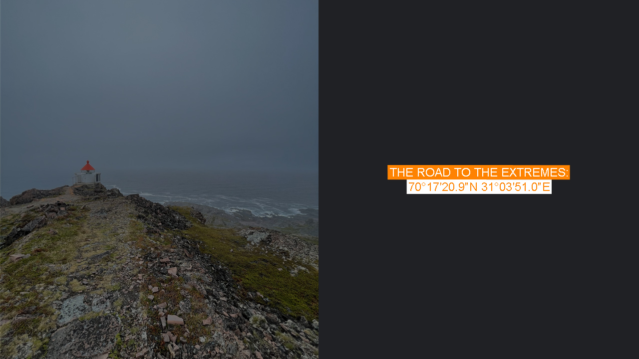
On a clear day, this would be a pleasant morning walk with a dog, up the hill to the small lighthouse that marks the easternmost point. But right now, I really have no clue where I’m headed or what lies ahead. Still, it’s only 3 kilometers to the lighthouse, so it’s more of a short walk than a hike.
In the summer of 1941, the German Navy began constructing a gun battery at Kibergsneset. The ruins still stand, but I’m more interested in a camping pick-up someone has hauled up to the hill, camping near the lighthouse. I’d wondered earlier if it’s possible to drive up, but I assume they’ve come via a different route, one from the other side of the hill.
On a clear day, you’d be able to see Russia and the endless waves of the Barents Sea, but for now, I’ll have to settle for the lighthouse. The easternmost point is down on the beach—an insignificant spot to most, but meaningful to those of us who obsess over these extreme points of land.
On my way back, I consider retracing my steps, but my curiosity gets the best of me. I head a little further up the hill to see the ruins. They’re really just ruins now, remnants of the German gun battery destroyed during Operation Northern Lights, a scorched-earth retreat involving 200,000 soldiers. Positions were abandoned, and all infrastructure was destroyed, including the battery. I later read that the battery did play a role in the war: in January 1943, it sank a Soviet submarine, and in July of the same year, it helped repel a Soviet landing attempt to the north.
When I return to the town, it’s still early. The seagulls continue to rule the place. The noise they make is relentless, but it’s not as eerie as before. Even the sun starts to peek out from behind the clouds. I leave, somewhat content, knowing I’ll return to this extreme place one day. I’ve checked the forecast, though, and heavy rain is expected for the next two days, so I change my plans. Kirkenes is my new destination. A night or two in a hotel will do me good—I am on holiday, after all.