
Until last summer, I had no idea an island called Kataja even existed. Tucked away in the northern Baltic Sea, within the Bothnian Bay National Park, Kataja is a binational curiosity: the island is split between Sweden and Finland, with the border literally running across its landmass. But it hasn’t always been a single island. Once, there were two: Finnish Inakari and Swedish Kataja. Over time, due to post-glacial rebound—land rising after being freed from the weight of ancient ice—the sea between them disappeared, and the two islands quietly became one.
This geological uplift continues today at an impressive rate of 8–9 millimeters per year, making the Bothnian Bay region one of the fastest-rising land areas in the world.
So when exactly did the merge happen? Officially, the 1809 boundary treaty between Sweden and Russia marked the islands as separate. Even maps from 1891 show two distinct landforms. But as for the moment they fused into one—no one seems to know for sure.
Despite these fascinating facts, I had somehow never heard of Kataja. And when I finally did, I pushed the idea aside. I had other plans, and visiting the island didn’t seem easy. There are no public ferries or regular access—just private options like boat taxis, seaworthy kayaks, jet skis, or your own vessel. Swimming is out of the question; the island is several kilometers from the nearest towns, Tornio and Haparanda.
I came close in late June, during a visit to Sundholmen—the easternmost point of mainland Sweden. I flirted with the idea of paddleboarding to Kataja, then considered a boat taxi, but the timing wasn’t right. The boat felt too expensive, and paddleboarding too risky without perfect weather. Kataja sits about 7 kilometers from the nearest harbor, and in a place like this, you’re entirely at the mercy of nature. The open sea here is unpredictable. There are even shipwrecks scattered around Kataja as proof.
Still, I couldn’t get the island out of my head. I kept circling back to it in my thoughts. The more I pondered, the more it seemed that a boat taxi might be the best investment—or maybe even a jet ski. But landing one on a rocky shoreline could be tricky. I had no idea what the coastline looked like.
Then a new idea struck me: what about winter?
When the sea freezes, a whole different set of possibilities opens up. In the Bothnian Bay, winter sports are common—from ice fishing to snowmobiling. Of course, conditions can be harsh: the days are short, the cold is punishing, and wind sweeping off the sea can be brutal. But the most important question would be: how thick is the ice?
The Finnish Meteorological Institute publishes both high-level and detailed ice maps. I began checking them regularly, hoping for a cold snap that would create strong, snow-free ice—perfect conditions for ice skating all the way to Kataja. That would have been the ultimate adventure. But living hundreds of kilometers to the south, predicting the perfect moment felt nearly impossible. Eventually, I accepted that cross-country skiing might be the most realistic approach.
It turns out that ski tracks are prepared in the national park to make skiing across the frozen sea more accessible. I learned that they maintain routes to Hanhikari and Torne-Furö—both a few kilometers south of Kataja. These tracks, groomed by snow machines, also signaled that the ice was likely thick enough to support safe travel.
By week 8—southern Finland’s ski holiday week—the season’s first tracks were laid. But prices surged due to the holiday, and the weather turned brutally cold. Mid- and northern Finland’s school holidays followed, and then the temperature began rising again. No new tracks were groomed. I started to wonder if I had missed my chance for the season.
But then, in early March, they groomed the trail again.
It was now or never. I couldn’t leave immediately due to work commitments, but I marked my calendar for the following weekend—mid-March.
Accommodation proved tricky. Tornio and Haparanda were fully booked for the night between Friday and Saturday due to a folk music festival. Last-minute travel didn’t help, and I ended up booking a hotel in Kemi for the first night instead. The train ride there was about 7 hours. A night train goes directly to Tornio, but it didn’t suit my schedule. Normally there’s good public transport between Kemi and Tornio—but not on weekends. That meant the first bus out was at 11 a.m., too late to make the trip to Kataja on Saturday. I had initially planned for that day because the weather forecast looked best, but in a stroke of luck, the forecasts flipped. Sunday would be clear and calm.
Dragging skis, poles, and a heavy backpack through snowy sidewalks wasn’t ideal. I even missed the stop by my hotel in Tornio and had to walk several hundred extra meters. Not a great start.
Snow was expected that evening, and I worried it might ruin the ski track. I set out to find the starting point anyway—Cementkajen, according to the maps. That meant little to me, but it made for a great walk and a chance to revisit Sundholmen, the easternmost point of mainland Sweden.
Tempted as I was to walk across the frozen border river between Sweden and Finland, I stuck to the footbridge like a law-abiding citizen.
The next morning, just before 9 a.m., I returned to Cementkajen with skis on my shoulder and cross-country boots click-clacking on the gravel. The sound of sand grinding against the soles of my boots was maddening. It was cold but calm—ideal conditions. I wore downhill ski goggles, probably looking ridiculous, but I knew from experience they were perfect for this kind of windless brightness. My backpack was stuffed with snacks from the day before and a pair of ice picks I’d picked up in Kemi—just in case.
The ski trail was pristine, as if freshly groomed. I later found out it had just been made that morning—I even met the snow groomer halfway to Hanhikari.
A few hundred meters in, just before Cape East, the trail split. I turned left, following a sign, but after a short while, I doubled back and took the other fork toward Sundholmen. In hindsight, both would have worked. Slightly annoyed at myself, I quickly let it go and focused on the perfect silence and glistening snow.
The full roundtrip to Torne-Furö from Cementkajen is around 11 kilometers. No matter how closely you study the map, nothing quite prepares you for how different the islands and seascape look in person.
It had been years since I last skied cross-country, and the rhythm of it brought back childhood memories. I wasn’t fast, but I was steady, and I enjoyed the solitude. Snowmobiles occasionally zipped past—some clearly headed for fishing spots, others just out enjoying the day.
Near Hanhikari, I veered off the groomed track, following a snowmobile path marked with sticks. The terrain was uneven, shaped by wind-carved snowdrifts. I kept my pace slow and steady. My only goal: to be off the ice before sunset.
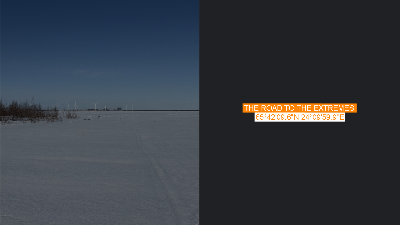
The further south I skied, the quieter it became. I felt truly remote—even though Röyttä’s steel factory and its giant windmills reminded me I wasn’t far from town. I had secretly hoped to see an icebreaker, but the only ship I spotted was a distant cargo vessel drifting behind Kataja.
Eventually, I reached the island.
Fresh snowmobile tracks cut across the border line, but I was alone—except for the tracks of a lone wolf that had padded past the border marker. Kataja is one of the rare places where you can stand in two countries at once on such a tiny piece of land. There are only a few islands in Europe like it.
I ate my yogurt lunch, took a few photos, and soaked in the moment before heading back, retracing my ski tracks as the sun lowered behind me. Though I’d hoped to see the northern lights that night, the space weather didn’t cooperate.
Still, I had crossed a sea and a border—on skis, in winter. And I finally reached Kataja, the island that wouldn’t let go of my imagination.