

“Any Bjargtangar puffins?”
“Yeah, there were like a dozen of them just behind the lighthouse, left side, a moment ago.”
“Well, at least something, after that road.”
“Haha, tell me about it. And now we get to do it all over again on the way back.”
“I know.”
And just like that, she set off in search of puffins—like many who make the journey to the westernmost point of Iceland: Bjargtangar, perched at the edge of the vast Látrabjarg cliffs, which stretch 14 kilometers and rise up to 441 meters above the Atlantic.
I had arrived in the Westfjords the previous evening, having spent nearly an entire day on the road from Húsavík. The puffins were a nice bonus, but I knew no sighting could top my experience on Hornøya. My real mission was to reach this geographical milestone. I’d already stood at the southernmost point of mainland Iceland, climbed its highest peak, and reached the easternmost and northernmost points of the mainland. Bjargtangar was the final point.
The region is undergoing infrastructure improvements under a project called The Westfjords Way, which means a mix of newly paved stretches and sections that are still rough and slow-going. New bridges are being built, and once completed, they’ll significantly cut down travel times. But outside the peak tourist season, with little traffic and stunning scenery all around, even the less-than-perfect roads had their charm. The only real hazard? Sheep—unconcerned by vehicles and often wandering right into the road.
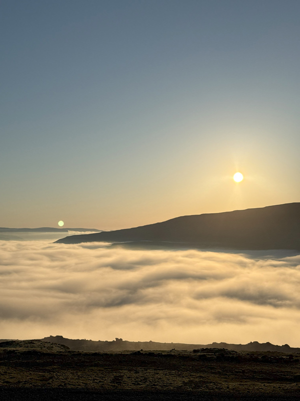
There were moments of fog along the way, though the weather had otherwise been mostly clear. Just before reaching Patreksfjörður, the road climbs to about 400 meters in elevation before dropping back down to sea level. From that height, I caught one of those special Icelandic sights: the sun low in the sky, casting golden light while clouds hung beneath the ridge. I stopped, tired but in awe.
Descending into the fog, reality returned. Visibility dropped to near zero, and I still had some distance to cover before reaching the night’s campsite. As I feared, the road wasn’t the most pleasant, and sure enough, a camper van had caught a flat tire. Someone was in the middle of changing it.
My camping spot was at Rauðisandur, accessible via an 11-kilometer gravel road. It might sound short, but first, you climb up and then descend sharply—with no guardrails. I had a 4×4 and the fog cleared on the ascent, but I took it slow, trying to avoid ending up like the camper van.
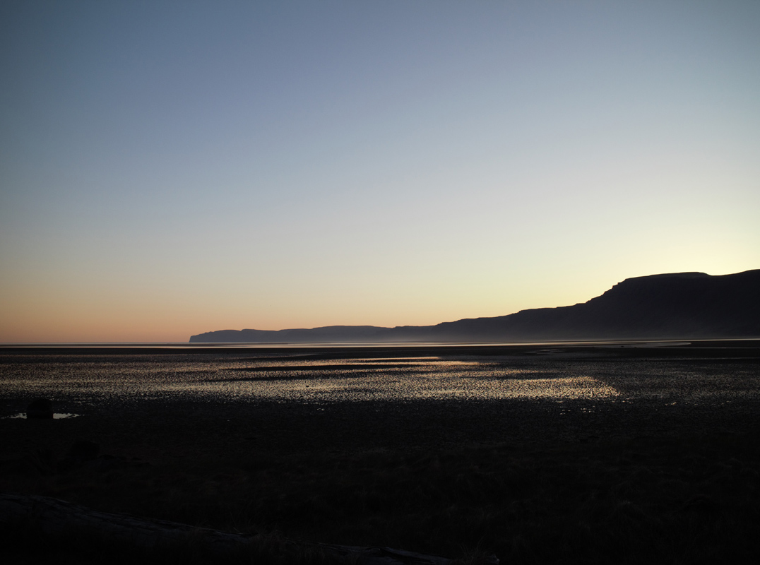
Coming down, I was rewarded with views that made the effort worth it. The sun had already set, but the sky still held hues of yellow and red. From the beach, I caught sight of the southern tip of the peninsula, just westward. The campsite had only recently opened for the season, and I was nearly alone.
The next morning, I had a relaxed conversation with the campsite keeper, who had just returned from his winter home in India. I asked him what there was to see aside from the beach. He told me about a seal colony a few kilometers away—definitely worth the walk. He also mentioned that on a clear day, you could see all the way to Greenland—though of course, that’s not physically possible, as Greenland lies several hundred kilometers away. Many visitors also hike up for panoramic views. I thanked him and said I’d do both—and also go for a swim. He raised an eyebrow, chuckled, and said, “You Nordics really are built differently.”
It was such a peaceful, beautiful place that I didn’t feel like rushing. I walked the beach alone, save for a few seals and distant fishing boats. The swim was cold but refreshing, and my hike ended up being longer than I’d planned. By the time I returned, the fog had rolled back in. It was already late in the day when I finally set out toward Bjargtangar.
That meant retracing the same 11-kilometer gravel road and then tackling nearly 40 more kilometers of unpaved terrain—something I hadn’t realized until I was already on it. The road was drivable, but the speed limit felt overly optimistic, and potholes were impossible to avoid completely. I couldn’t help but wonder if the camper van’s tire had given out somewhere along here.
Still, the scenery kept changing—cliffs, beaches, and even the wreckage of a U.S. Navy plane scattered across the landscape. Eventually, I reached the parking lot at the road’s end. The sun, which had been forecasted to shine until noon, had long disappeared. The sky was grey, the air a brisk 10°C, with a light wind by Icelandic standards.
The westernmost point itself is just a few dozen meters from the parking area. It’s surprisingly easy to reach if you’re up for the long drive and the gravel. In these conditions, most cars could manage it—with patience.
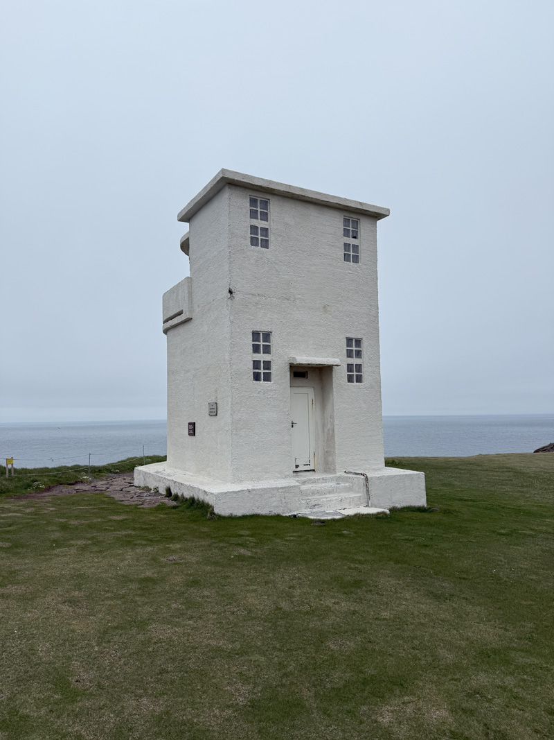
A small lighthouse stands at the point, six meters tall, alongside a support building. Both are simple and practical, nothing special to look at. Built in 1948, the lighthouse marks the westernmost building in Europe when the Azores are excluded. It also happens to be the westernmost point in the Greenwich Mean Time (GMT) zone.
But it’s not about the buildings. It’s about the nature.
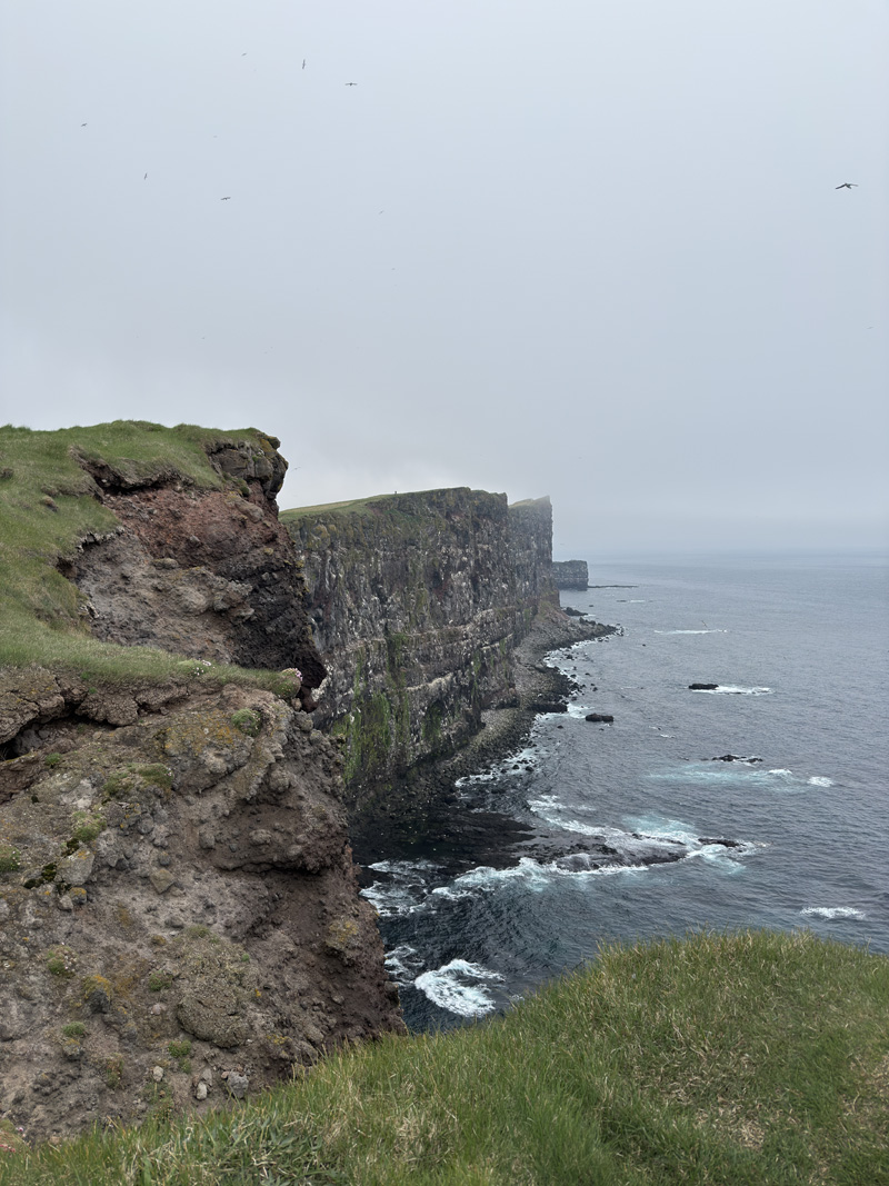
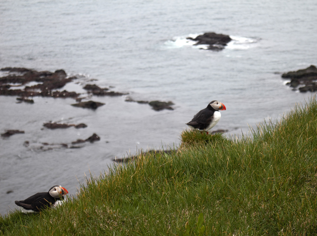
Látrabjarg is home to hundreds of thousands of seabirds during nesting season—guillemots, razorbills, fulmars, kittiwakes, puffins, and Brünnich’s guillemots. Most visitors come for the puffins, though they weren’t in full view at first. One lone puffin had attracted a dozen tourists’ attention, all taking turns for the perfect photo.
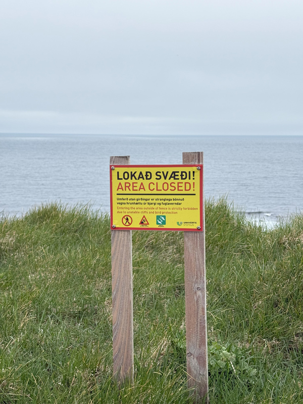
I continued along the trail for a while, taking in the cliffs—dramatic and beautiful, but also dangerous. There are no barriers, and the ground can be unstable near the edge. In 2008, a German tourist tragically fell to their death here. Caution is not optional.
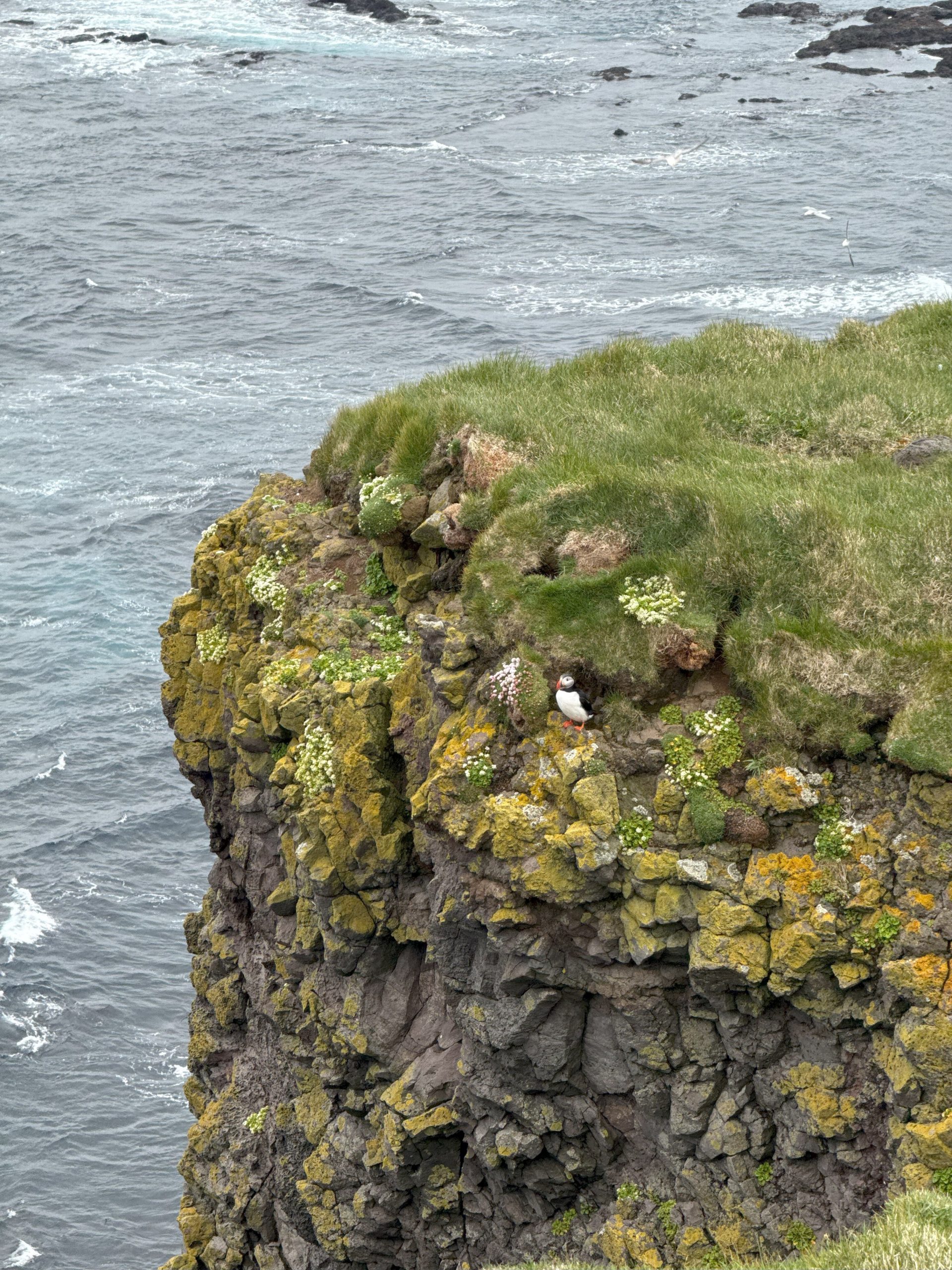
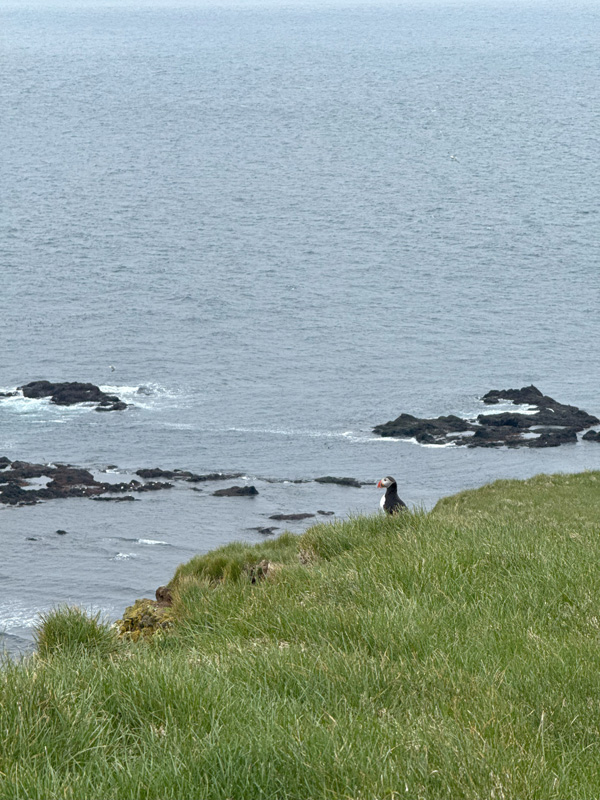
Back at the lighthouse, I was rewarded for my patience. A dozen puffins had finally emerged, putting on a quiet little show and wrapping up the experience perfectly.
On my way in, I had noticed a nearby campsite. It was already getting late, and I knew I wouldn’t make it anywhere for dinner—or even a late lunch. I figured the smartest move was to rest and get an early start the next morning. Rain was in the forecast, and I wanted to reach the Golden Circle before it arrived. I was still a tourist after all, and what’s a trip to Iceland without seeing the geysers?
Fact sheet
Title(s): The westernmost point of Iceland, the westernmost point in the Greenwich Mean Time (GMT) zone, the westernmost building in Europe when the Azores are excluded
Approxiate coordinates: 65°30’08.4″N 24°32’00.0″W
On map: