Kötlutangi hasn’t always been the southernmost point of mainland Iceland. This remote spit of land only came into existence in 1918, forged by the raw fury of nature. That year, the Katla volcano erupted beneath the massive Mýrdalsjökull glacier, unleashing a violent glacial flood—a jökulhlaup—that carried an immense load of volcanic sediment toward the coast. In the wake of this upheaval, the land stretched several kilometers farther into the sea, creating Kötlutangi.
Katla is infamous for its brutality. Its eruptions—recorded in 1918, 1860, 1823, 1755, 1721, 1660, and 1625, among others—are among Iceland’s most ferocious. Because the volcano lies beneath a 400–600-meter-thick glacier, every eruption melts huge volumes of ice in a matter of hours, triggering devastating floods that sweep down toward the sea, dragging ash, silt, gravel—and even icebergs—with them.
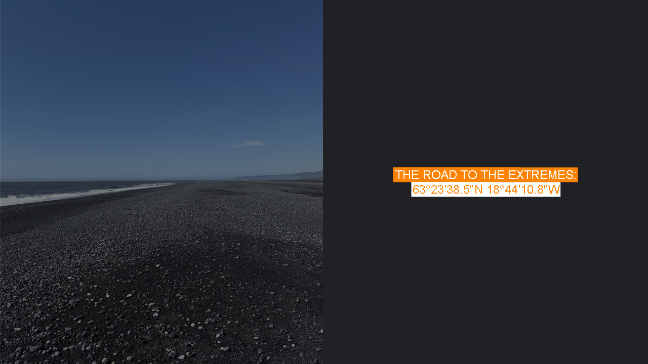
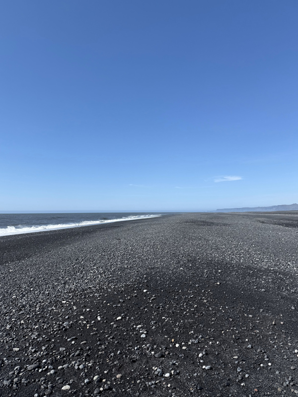
These floods have shaped much of the Mýrdalssandur sandflats and are responsible for the iconic black beaches of Iceland’s south coast. The sand, ground down from volcanic basalt and reworked by relentless ocean waves, is darker and finer than anything you’d find in a tropical paradise. Reynisfjara and Kötlutangi’s shoreline owe their existence to these cataclysmic forces.
After the 1918 eruption, the coastline extended 3–4 kilometers southward, temporarily giving Kötlutangi the title of Iceland’s southernmost point. But the sea is always pulling it back—erosion is estimated at about 10 meters per year. In the absence of a new eruption, the title may soon return to Dyrhólaey, which held it before 1918. Nature is the ultimate cartographer here.
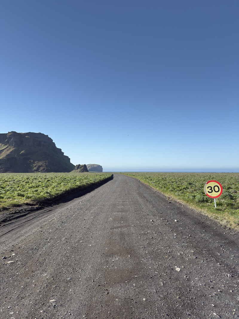
Kötlutangi lies just off Iceland’s Ring Road (Route 1), about 200 kilometers from Reykjavík and a short 15-kilometer drive from Vík í Mýrdal—a town known for its photogenic cliffs, black sand beaches, and the dramatic Dyrhólaey headland. It was once possible to drive all the way to Kötlutangi with a sturdy 4×4, but as of 2025, off-road driving has been banned, and there’s now a parking fee. Unfortunate progress, I suppose.
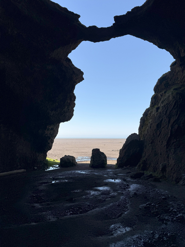
From the parking lot, most visitors seemed more drawn to Gígjagjá—the so-called “Yoda Cave”—than the sprawling black desert. Personally, I didn’t find the cave spectacular, though it’s easy to reach and definitely a fun stop for Star Wars fans. The cave sits in Hjörleifshöfði, a 220-meter-high tuya—a flat-topped volcanic mountain formed when lava erupts beneath a glacier. This peculiar formation likely rose during the last ice age and may once have been an island, surrounded by a fjord called Kerlingarfjörður.
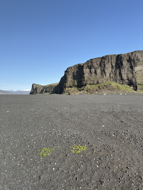
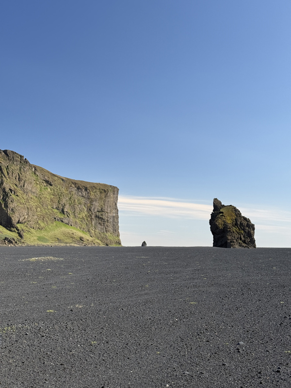
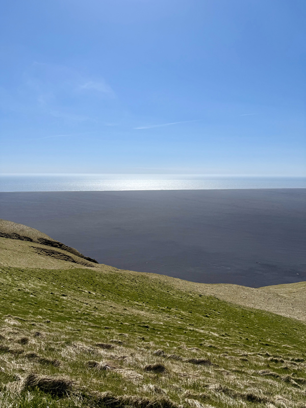
To reach Kötlutangi itself, you’ll need to walk 2–3 kilometers across a stark, monochrome landscape of nothing but black sand stretching to the horizon. The sea looks deceptively close, but the walk takes longer than you think. I made the classic mistake of not bringing water, assuming it would be a quick there-and-back stroll. But time bends out here. The emptiness is hypnotic. The silence, broken only by the pounding surf, pulls you into a meditative state.
Despite calm weather, the waves crashed onto the shore with force. It’s not a place for swimming, I thought to myself, the currents could be unpredictable and dangerous. You stand there at the edge of a continent, staring into the Atlantic, aware that this place didn’t exist just over a century ago. That it might not exist a century from now.
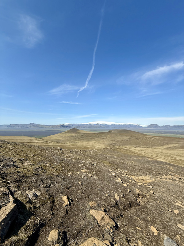
On my way back, I noticed hikers silhouetted along the ridgeline of Hjörleifshöfði. I couldn’t resist the pull. After some searching, I found the start of the trail—just past an earlier parking area—and began the climb, postponing lunch, as always.
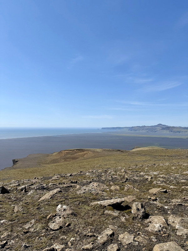
The reward was spectacular. From the summit, I had a panoramic view in every direction: to the south, Kötlutangi; to the north, the shimmering expanse of Mýrdalsjökull; westward, the cliffs of Dyrhólaey; and to the east, the towering glaciers of Vatnajökull and the majestic Hvannadalshnúkur—my next target, though it was already causing me some logistical headaches. But nothing worthwhile is ever too easy.